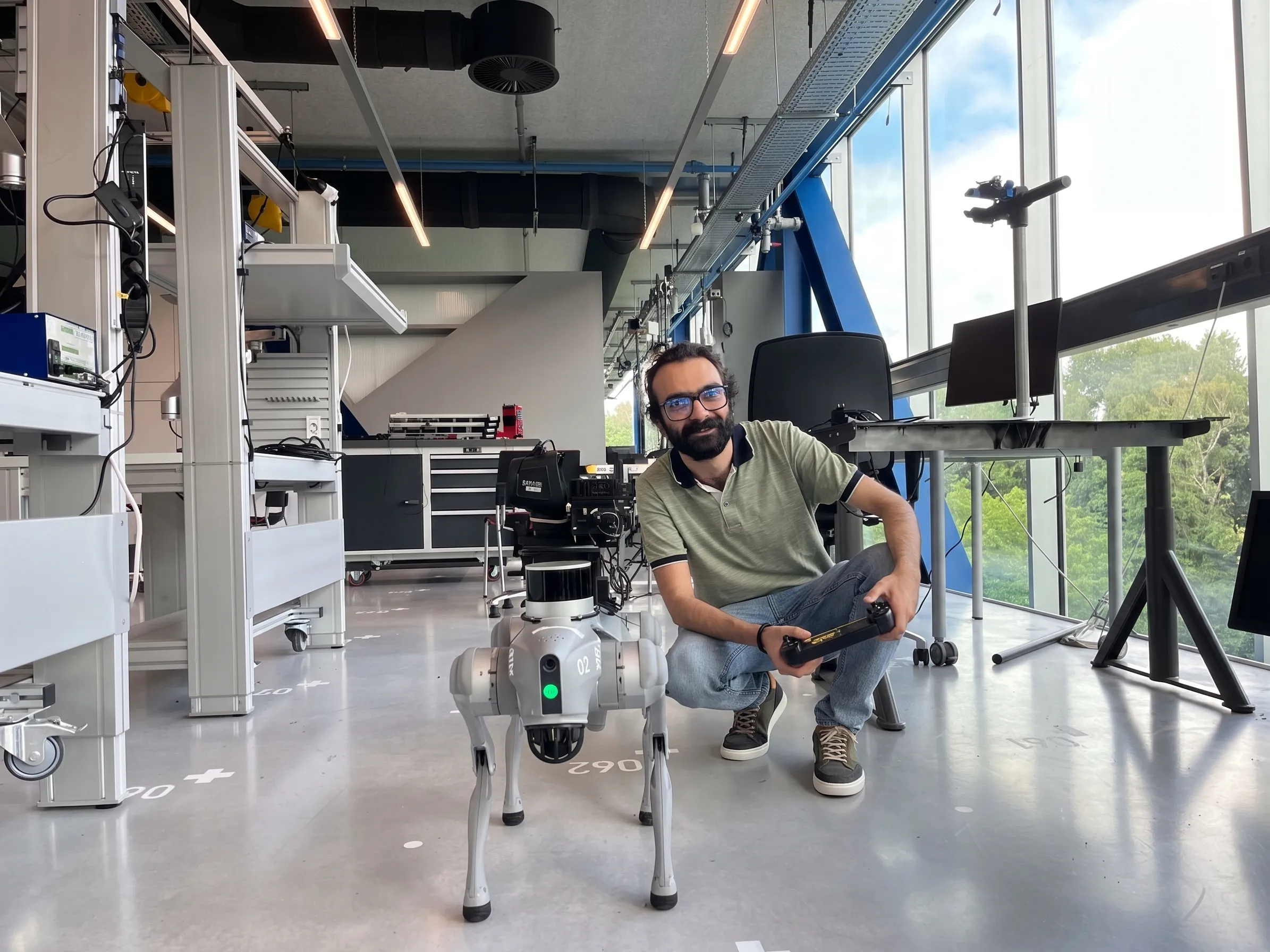
Unitree Go2 Quadruped Autonomous Navigation & SLAM
Ongoing exploration in 3D LiDAR odometry, Fast-LIO and Point-LIO SLAM, and Nav2 autonomous navigation
Project Overview
This is an ongoing robotics project focused on autonomous navigation and inspection using the Unitree Go2 quadruped platform. Because the final system architecture is still under active development, the current work is an exploration dedicated to 3D LiDAR odometry and direct LiDAR-inertial SLAM pipelines.
The investigation currently focuses on evaluating algorithms like Fast-LIO and Point-LIO to achieve low-drift state estimation during dynamic locomotion, paired with the ROS2 Nav2 stack for autonomous path planning and terrain traversal.
Project Goals: Autonomous Navigation and Inspection
The primary objective is building an autonomous quadruped system capable of routine inspection runs, environment mapping, and obstacle negotiation in complex environments where wheeled platforms cannot operate.
Legged robots introduce significant body oscillations, abrupt foot-ground impacts, and rapid rotational motions. Achieving reliable autonomy requires solid 3D LiDAR-inertial odometry that stays accurate without drifting when the robot trots across slopes, stairs, or uneven floors.
Current State: 3D LiDAR SLAM and Nav2 Exploration
Rather than locking into a single pipeline, work is actively focused on testing and evaluating 3D LiDAR methods:
- LiDAR-Inertial SLAM Evaluation: Comparing Fast-LIO and Point-LIO to measure odometry stability and processing overhead under dynamic quadruped gaits and vibration profiles.
- Direct Point Registration: Testing incremental k-d tree (ikd-Tree) structures to maintain dense point clouds and high-frequency state estimation directly from raw LiDAR scans and IMU measurements.
- ROS2 Nav2 Path Planning: Feeding LiDAR-generated point clouds into Nav2 costmaps to evaluate 3D elevation mapping, obstacle clearance, and goal-directed autonomous path execution.
Hardware Setup